|
2001 Aug. 25 - Redington Mtn |
|
|
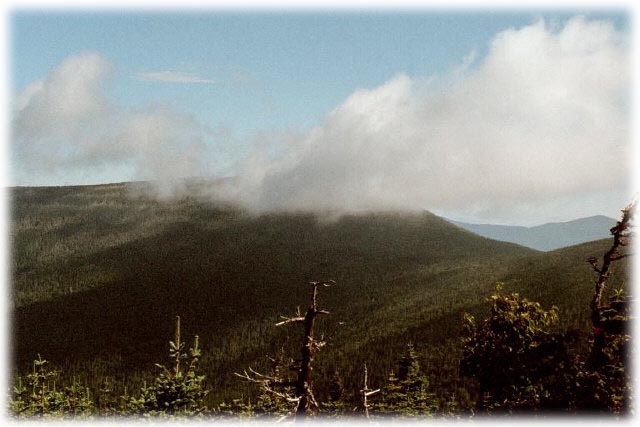
| Crocker North Peak as seen from Redington |
| This 4010 foot mountain is the easiest hike of the Maine 4000'ers, but doesn't offer many views with its forested summit. |
|
DirectionsM
One mile west of the Sugarloaf/USA entrance on Maine Route 27, turn south on Caribou Valley Road. Proceed 4.5 miles to a small parking area where the Appalachian Trail crosses the road. Hike along the road from that point (optionally it may be possible to drive about 1 mile further to the next intersection, but beyond that point Caribou Valley Road becomes impassable). Cairns and wooden arrows formed of small logs point the way at the remaining intersections. |
Trail
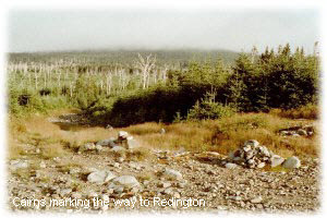 There is no formal hiking
trail. Follow Caribou Valley Road to its end, then turn right just before the bridge. This turn is marked by a
cairn, as are all the other turns on the route to Redington. It is a series of old logging roads most of the way
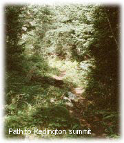
up, with quite a lot of new tree growth starting. The final ascent to the peak is a narrow foot path, easily followed.
There is no formal hiking
trail. Follow Caribou Valley Road to its end, then turn right just before the bridge. This turn is marked by a
cairn, as are all the other turns on the route to Redington. It is a series of old logging roads most of the way
up, with quite a lot of new tree growth starting. The final ascent to the peak is a narrow foot path, easily followed.
|
![]()